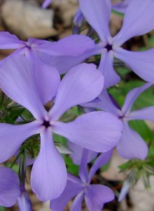
The next morning I stopped at the visitor center to get a map of the park and information on some of the trails. Half a mile from the campground was the trail to Cottonwood Spring. It was an easy walk along a gravely path and dry sandy stream. Arriving at the stream, there was simply a sign identifying the place where the Spring had been. Rather anti-climatic but it was a nice walk; the sun was shining and there was a nice breeze.
There were several other trails in the area but the southern part of the park, to me at least, wasn't all that interesting. So I hit the road and headed north where the Joshua Trees and the Jumbo Rocks were located.
Along the way there were a few things to see – the Cholla Garden and Ocotillo Forest.
 The Cholla Garden was planted by Mother Nature. You do see the Cholla in other areas of the park but usually just a few hanging out together. Here in the garden they grow in abundance.
 The cholla also have incredibly sharp, hooked needles that are difficult and painful to extract if you happen to get one stuck on you. I was very, very careful walking through that garden!
 The Ocotillo are interesting also. They can get quite tall, this one was about 15 feet high. Much of the year it looks like a bunch of spiny dead sticks. But after it rains, the Ocotillo is covered with very small leaves. Like other deciduous trees, the Ocotillo loses it's leaves but not due to the changes in the season. Rather, for the Ocotillo, the leaves fall when there is no water. The long stems are often used for fencing material and for walking sticks.
 The bright red flowers of the Ocotillo appear on the tips of the stems in spring and summer.
 A “tube” of Ocotillo flowers.


 In Belfast Harbor. Getting ready to head out.
 Looking out into the open ocean. Islands off in the distance.
 Lobster trap buoys and the kayak paddle.
 Two hours later, heading back towards the harbor.
 Me and my cousin!


 I'm sitting on what I think is part of an old wagon for hauling out the logs that were cut in this little canyon all those years ago.
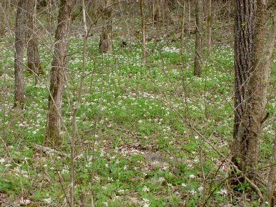
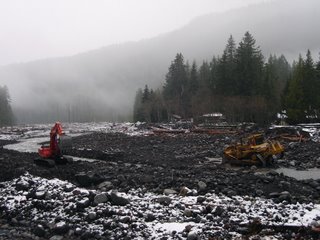 The road to Mt Rainier National Park's recovery is passing through some interesting terrain. Today, I saw a large bulldozer working in the Nisqually River. One of the vexing problems for the NPS is that rivers and streams have jumped their main channels. During a storm, riverbeds can become filled with debris, which in turn causes the river's flow to change its course. To some extent, that is why the
 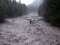 The historian in me wanted to capture a during and after view of the Nisqually River. Here is the "during" image from Monday afternoon, Nov. 6th when things really started to roll. This picture is taken from the Longmire bridge looking upstream.
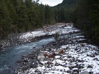
 Our vessel was the 80-foot Ptarmigan, shown here coming in to shore prior to our tour.
 From the visitor center, Portage Glacier is hidden behind the mountain outcropping on the right.
 Portage Glacier is on the right. It is called a valley glacier since it goes all the way into the valley. It is 450 feet deep but since there is nothing to give it perspective there was no way to really judge how high it was.
 Photographs certainly do not do it justice! The rocks facing us in the center are 175 feet high!
 A portion of the face of the glacier.
 The closest we got was 300 yards away because of the possibility of calving – where ice breaks away and drops into the water. We didn't see any calving but felt the wake of a shooter – where a piece of ice breaks off beneath the surface and pops up out of the water.
 There was a Forest Ranger on board who provided some scientific information about glaciers but, honestly, I wasn't paying attention! The blue color of the ice was intense and amazing. If you want to know more about why the ice is blue, check out this Causes of Color website.
 In some places the ice hangs over the surface of the water, thus the “dark line” where the ice meets the water.
 To put it into perspective, the Captain showed us a photograph taken a few years ago. He let me take a picture of that photograph and it is being used with his verbal permission. The Ptarmigan (the tour boat we were on) is floating in the middle of the bay amongst smaller icebergs in the same location as we were in – 300 yards away from the face of the glacier – and the boat (the largest of the floating objects) is merely a speck in the water.